Objectives


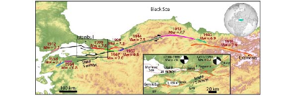
fault strands of the NAF (Northern NAF, Middle NAF and Southern NAF). The sequence of the last major earthquakes of the twentieth century (respective age, location, and moment magnitudes indicated from USGS earthquake catalog; https://earthquake.usgs.gov/earthquakes/search/ and Stein et al., 1997) shiws a westward propagation of the rupture through time. The seismic gaps at the western termination of the NAF are shown as black lines. Inset is a zoom of the studied part with the different strands of the NAF. GPB refers to the Geyve‐Pamukova Basin and BP to the Bursa Province.
Focal mechanism solutions are retrieved from Tibi et al. (2001). Active faults are shown in red (Benjelloun, 2017; Emre et al., 2018).
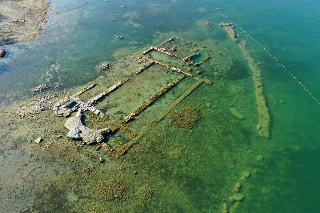
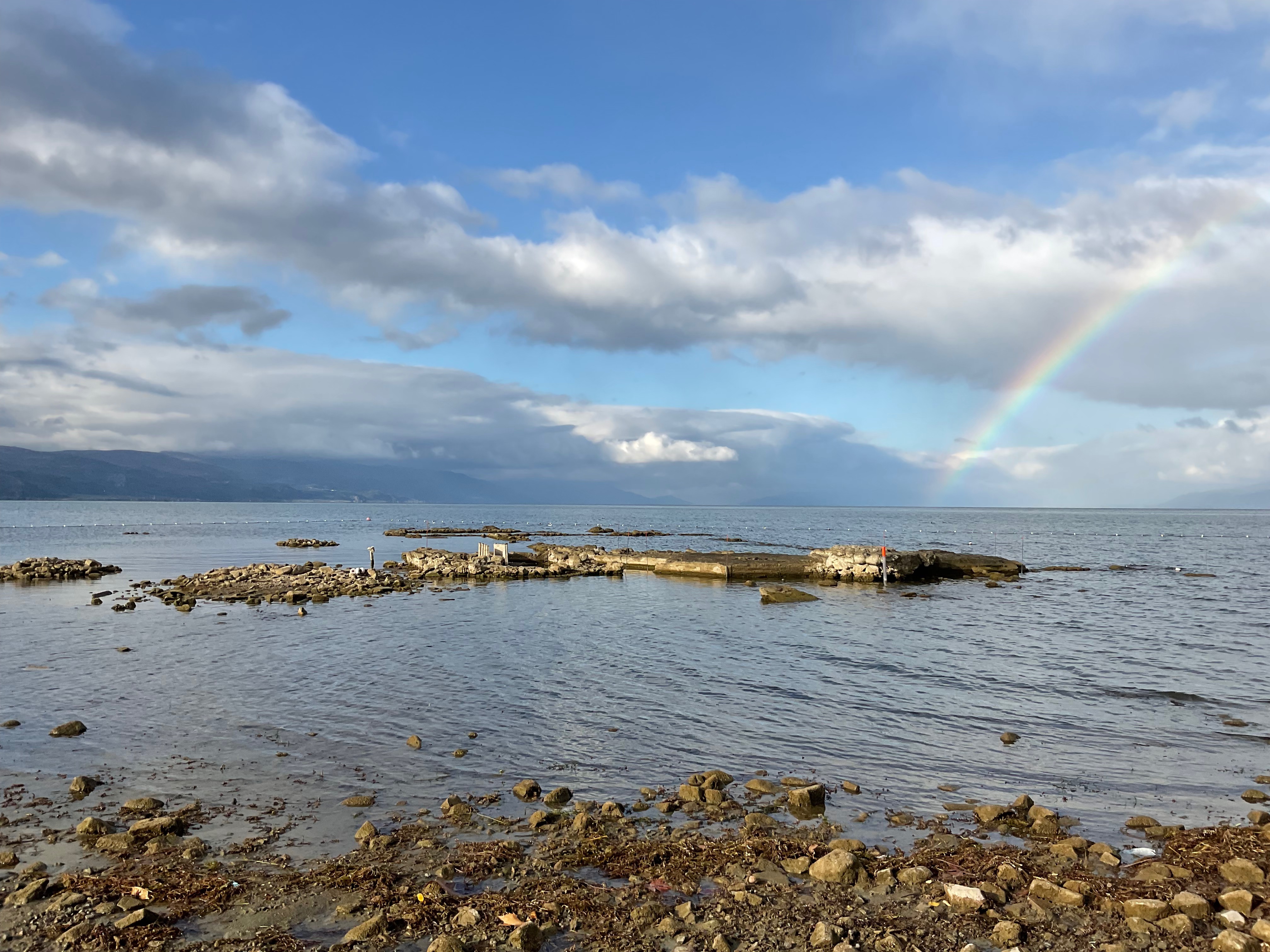
In this project, we want to clarify the cause and timing of the basilica’s destruction (WP1). Archaeological survey will specify the stratigraphy of buildings and the timing of basilica lifetime. Cores of sediments (2 m) in and around the basilica can document the seismic history on the site. Dates below and above the basilica ground will frame the age of its construction and destruction. The mechanical properties of the soil on the shore and trenches may highlight potential liquefaction markers that may have led to destabilization of the ground and creep of the basilica into the lake. It is all the more important to assess the vulnerability of this site as it will become an underwater museum.
To improve our knowledge on the seismicity of this zone (WP2), we will map the faults in the Lake Iznik and Çerkeşli (20 km eastward) during bathymetric and seismic surveys, looking for straight lineament where super-shear earthquake could occur. The mass-wasting deposits in the deep part of the basin are evidences of past earthquakes or extreme precipitations. We will map them in 3D, and core (25m) them to obtain a long calendar of past seismicity. Short cores (2 m) collected from different areas of the two lakes will confirm their seismic origin and assess their spatial extension. Earthquakes and extreme precipitations events will be distinguished using sedimentological and geochemical analyses on the turbiditic sediments cores. On land, trenches will digg on the MNAF to attribute some segment rupture to earthquake dates. These data will be uses to improve the probabilistic seismic hazard assessment of the MNAF.
Changes in climate, biodiversity and human practices around the lake (WP3), can also be highlighted through soil-erosion proxies and the analysis of ancient DNA (aDNA) metabarcoding in the lacustrine sediments. Such analyses will help to understand the causes of lake and ground level variations as well as the multiple feedbacks between tectonic, climatic and anthropic factors.Retour ligne automatique
This pluridisciplinary project will help to elucidate the secrets of the lost basilica, cradle of the Christianity, to better know the seismic cycle on the MNAF and on the NAF system and to understand how tectonics, climate and anthropization interact and can change the fate of human communities.
The objectives of this proposal are:
Work Package WP1
To establish the timing and causes of the catastrophic destruction and submersion of the basilica using new data on its history based on geological and archaeological arguments. The basilica was built on the shore of the lake on a sandy soil. We suspect that site effects such as liquefaction could have destabilized, destroyed and dragged the basilica into the lake during earthquake shaking. To test this hypothesis, we will have to determine the soil properties around and in the site of the basilica, and to observe potential fluid-escape sedimentary figures on trenches. The recent lowering of the lake level allows to establish touristic infrastructures on the shore (hotels, restaurants, housing and a future museum under the water), and it is important to take into account the possible sites effects for the seismic risk assessment for these planned infrastructures.
Work Package WP2
To characterize the MNAF seismic behaviour through the Quaternary period. To achieve this goal, we need a map of the active fault segments, particularly in the lakes Iznik and Çerkeşli, to have an accurate calendar of seismicity for the last several thousands of years, to determine the location of the ruptures on the fault (on-land and off-shore), and to have an idea of the magnitude for the large earthquakes. With this data, we will strongly improve the seismic hazard assessment in this very touristic to become, and will integrate them at the scale of the NAF system.
Work Package WP3
To reconstruct and understand past, the variations of lake levels through time and environmental changes in this area will be investigated, such as the one that led to the basilica flooding, and to observe their consequences on human settlements. Lake-level variations can be related to tectonic, hydrologic (climatic) or human forcing. This study will highlight the complex interactions between earthquakes, hydrology, lake level and human activities in the Iznik area through the geochemical and DNA metabarcoding studies of the sedimentological cores sampled in the lake.


